Verified Views: What They Are and Why They Matter
Verified Views have emerged as a crucial tool in the planning process, providing accurate visual information that serves as the backbone for planning applications and stakeholder engagement.
Unlike traditional CGIs, these views offer a clear, objective look at potential developments, helping professionals navigate the complexities of landscape and visual impact assessments with confidence.
Also known as Accurate Visual Representations (AVR), Verified Images, Visually Verified Montages (VVM), Verified Photo Montages, and Certified Views, here we explore how these powerful visual aids can enhance your projects, mitigate risks, and foster successful collaborations.
Why are Verified Views so important?
Verified Views play a crucial role in the planning and development process, offering objective representation of the exact impact a development will have on its surroundings once built. Let’s explore these aspects in more detail.
Keeping it real, avoiding objections
Verified Views provide an unbiased and accurate depiction of proposed developments within their existing context. These visual aids are essential for planning applications, offering a reliable foundation for decision-making.
The key is that they eliminate the subjective interpretations that can lead to misunderstandings or disputes. These objective representations of a proposed development are particularly valuable in sensitive areas or when dealing with heritage sites. Allowing planners and stakeholders to assess the visual impact of a project with confidence ensures that decisions are based on accurate information, rather than speculation.
Verified Views vs CGIs
While CGIs are often created for marketing and design presentations, Verified Views serve a different purpose: to provide an objective, planning-compliant representation of a proposed development within its context. Often they are a legal requirement within the planning process.
Unlike CGIs, which can be stylised or enhanced to present an aspirational vision, Verified Views follow a precise methodology to ensure accuracy in scale, positioning, and environmental conditions. This level of detail is essential in the planning process, helping planning authorities and other stakeholders to assess the true visual impact of a project with confidence. By eliminating ambiguity, Verified Views support better decision-making and help to address potential concerns early on.
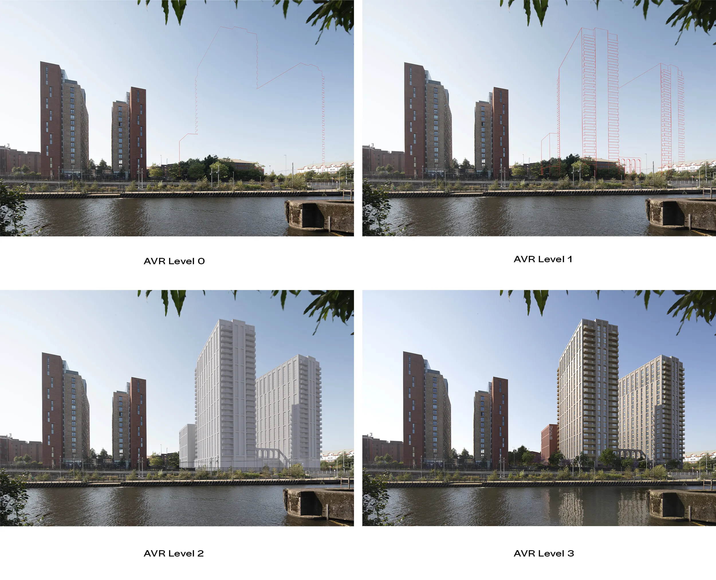
Understanding AVR Levels
Accurate Visual Representation (AVR) levels, ranging from 0 to 3, are a framework for categorising the level of detail and realism in Verified Views. Each level has a specific purpose and application in the planning process.
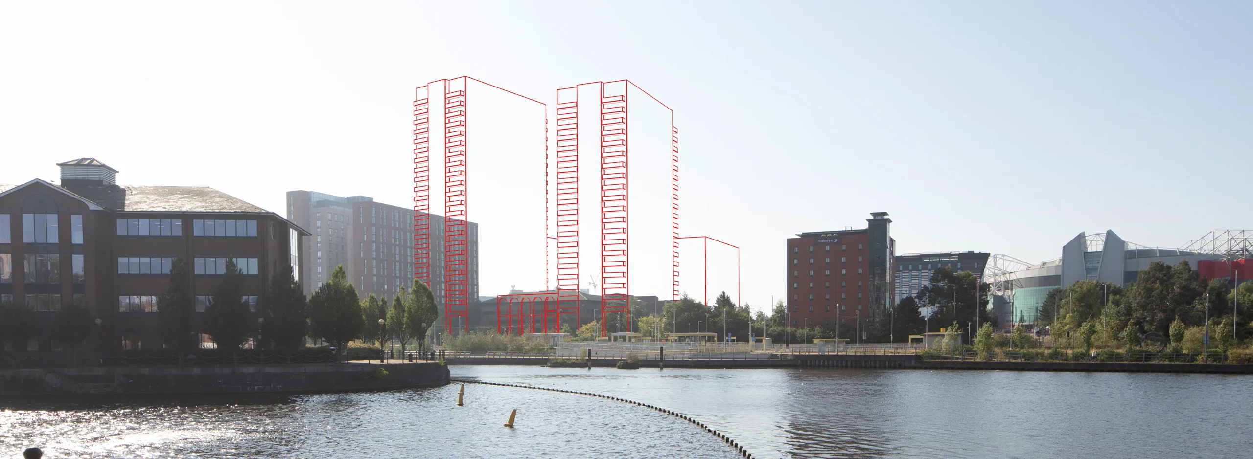
- AVR 0 provides a simple wireframe outline of the proposed development. This is useful for early-stage discussions and massing studies, helping to communicate the general form, scale, and position of a project without additional detail.
- AVR 1 builds on this by introducing more definition, including a more detailed outline of the proposed structure. This level is often used for preliminary impact assessments and early stakeholder engagement, offering a better understanding of visibility and scale within the existing context.
- AVR 2 takes the process further by presenting a white shaded render of the proposed development and its architectural form. This level is commonly used in formal planning applications, providing a realistic yet neutral representation of the proposal.
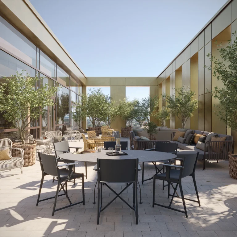
- AVR 3 is fully rendered and includes realistic materials, reflections, and atmospheric conditions to provide a true-to-life visualisation of the development. This level is particularly valuable for sensitive locations or high-profile projects, where an accurate and highly detailed representation is essential to aid decision-making.
The Verified View process
There’s more involved in creating Verified Views than meets the eye. Verified Views are built on a rigorous, methodical process that ensures accuracy, reliability, and credibility in planning applications.
Step 1: Viewpoint Selection & Photography
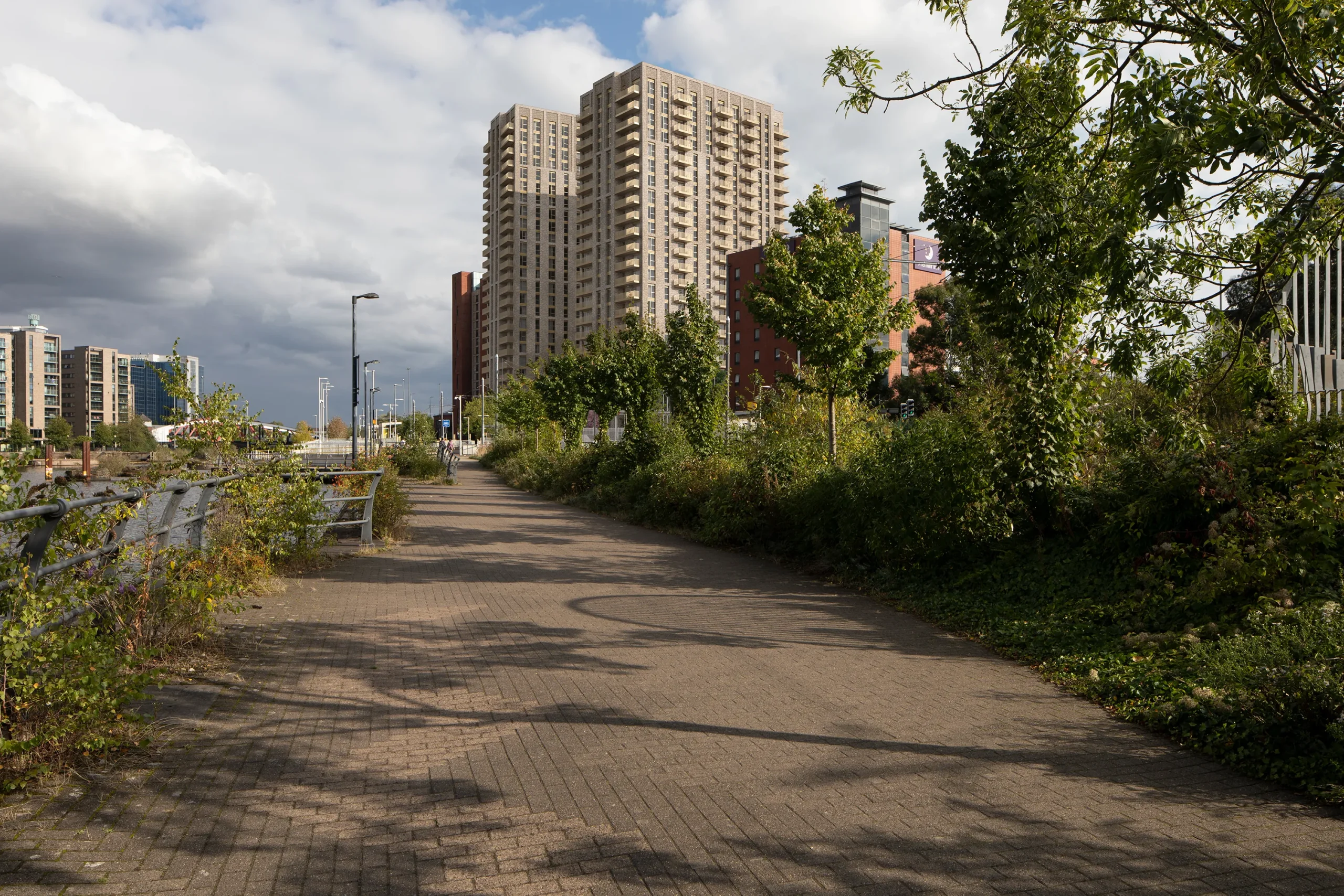
The process begins with selecting viewpoints that best represent the proposed development’s impact on its surroundings, taking visibility, sensitivity, and public accessibility into account. Once the viewpoints are finalised, high-resolution photography is taken under controlled lighting and weather conditions, with precise documentation of camera settings and GPS coordinates.
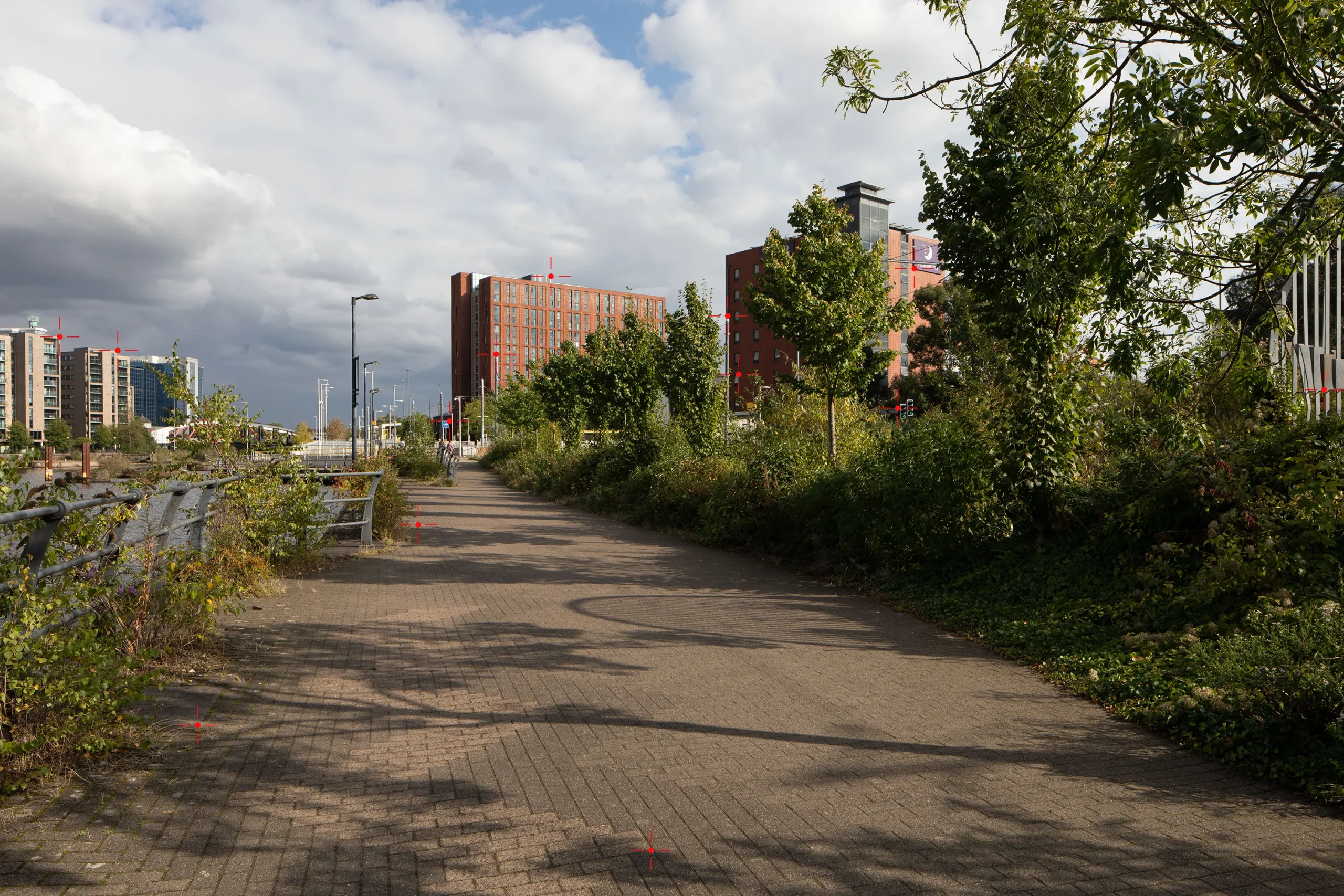
Step 2: Survey
A detailed survey is carried out to establish accurate spatial data for each selected viewpoint. This provides a critical foundation for integrating the proposed development into its real-world setting.
Step 3: 3D Modelling
Next, a highly detailed 3D model of the proposed development is created. This ensures the building or structure is represented with complete accuracy before being placed within its real-world context. To ensure a realistic representation, the model is developed with precise geometry, material textures, and environmental lighting conditions that match the proposed scheme.
Step 4: Camera Matching
At this stage, the 3D model is carefully aligned with the real-world photography. Using advanced software, the virtual camera is calibrated to match the exact position, focal length, and perspective of the original photograph.
Step 5: 3D Rendering
With the model now positioned correctly, rendering is carried out to ensure the Verified View is as realistic as possible. This involves simulating real-world lighting conditions to match the original photograph and applying accurate materials and textures to the development.
Step 6: Photomontage & Post-Production
The rendered image is then merged with the original site photograph to create a polished, Accurate Visual Representation (AVR). This stage ensures the final image is not only technically accurate but also clear, professional, and suitable for planning submissions.
Step 7: Methodology Report
To provide full transparency and in order to the images to be verifiable, a Methodology Report is produced detailing every stage of the production process, including a breakdown of viewpoint selection and survey methods.
What are the benefits of Verified Views?
Beyond being a legal requirement in many cases, Verified Views offer other advantages in the planning and development process. Let’s explore how they provide credibility, mitigate risks, and enable accurate visualisations.
Credible proposals, reduced risk
Verified Views give credibility to a planning application and help mitigate potential risks associated with visual impact assessments. Their accuracy and objectivity provide a solid foundation for decision-making.
By presenting realistic and verifiable representations of proposed developments, Verified Views:
1. Increase trust among stakeholders, including planning authorities and local communities
2. Reduce the likelihood of objections based on misunderstandings or inaccurate perceptions
3. Provide a robust defence against potential legal challenges related to visual impact
High levels of accuracy
Verified Views provide accurate visualisations of proposed developments, benefiting both developers and stakeholders.
Key advantages of accurate visualisations include:
1. Facilitating informed decision-making by providing a realistic preview of the completed project
2. Enabling stakeholders to assess the visual impact from various viewpoints and distances
3. Supporting effective communication between architects, developers, and planning authorities
Getting Verified Views right offers a route to success in the planning process and helps you to build lasting trust with planning officers, local stakeholders and communities. Get in touch with us to explore how we can assist you with producing Verified Views.